
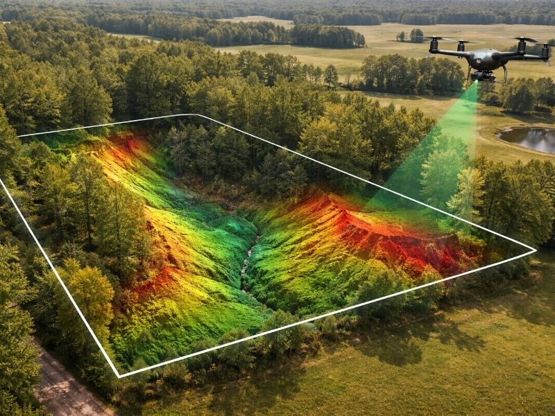
LiDAR Mapping for Large Rural and Agricultural Land
You can’t build on land you don’t fully understand. Rural and agricultural parcels hide problems that don’t show up on paper. Drainage issues, elevation shifts, buried ditches, wetland edges. Most traditional surveys miss them entirely.
LiDAR mapping changes that. It scans every inch of a large parcel fast, with detail that ground crews can’t match. For developers working on rural or agricultural sites, it’s not optional. It’s how you avoid expensive mistakes before you pull permits.
This article breaks down how LiDAR works on large land, what it costs, when to use it and what the data actually tells you.
Why Large Rural Land Needs LiDAR
Big parcels have problems that only show up at scale.
A 500-acre farm looks flat from the road. The data tells a different story. Subtle drainage patterns, micro-elevation changes and old field roads all affect your development plan. So do wetland boundaries hidden under grass or crops.
Without accurate topographic data, developers run into the same problems over and over:
- Earthwork volumes get underestimated, often adding $50,000 to $200,000 to a budget
- Drainage plans get built on wrong slope data
- FEMA flood zone edges at property lines get missed
- Permit submissions get delayed from incomplete topographic maps
None of that is a small problem. Each one can kill a project timeline or blow a budget.
How the LiDAR Mapping Process Works
Most rural LiDAR projects follow four steps from flight to finished file.
Step 1: Project Scoping
Define your acreage, required accuracy and output format. Common formats include contour maps, a Digital Terrain Model (DTM), a Digital Surface Model (DSM) or a raw point cloud.
Step 2: Flight Planning
The survey crew plans flight lines based on parcel shape and vegetation density. Open agricultural land needs fewer passes than wooded parcels.
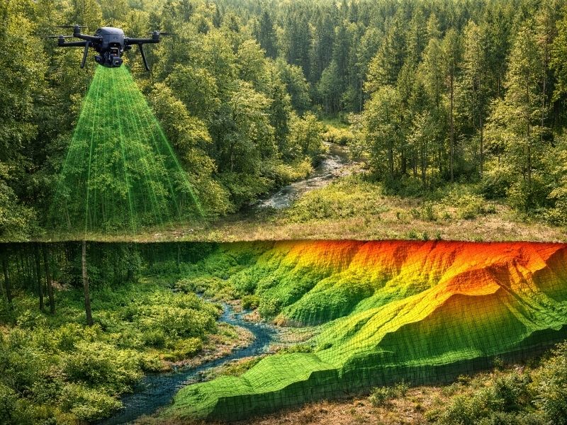
Step 3: Data Capture
A fixed-wing aircraft or large drone flies the site. On open farmland, one flight can cover 1,000 or more acres in a single session.
Step 4: Processing and Delivery
Raw point clouds get cleaned, classified and converted into usable files. Standard formats are GeoTIFF, LAS and DWG.
What You Get at the End
- DTM: bare-earth elevation with no trees or structures
- DSM: includes vegetation and buildings
- 1-foot or 2-foot contour maps
- Breaklines for drainage and grading design
- Accuracy certification report
LiDAR Costs for Large Rural Parcels
Pricing depends on acreage, accuracy requirements and turnaround time.
Rough benchmarks for agricultural land (2025-2026 rates):
- Under 500 acres: $2,000 to $6,000
- 500 to 2,000 acres: $4,000 to $12,000
- 2,000-plus acres: $2 to $5 per acre for basic surveys
Engineering-grade accuracy adds 30 to 50% to the base cost. That’s worth it when your grading plan depends on the numbers.
When the Cost Pays Off
- Any grading project over 50 acres
- Sites with unknown drainage or wetland conditions
- Parcels where earthwork estimates will drive financing decisions
- Agricultural land being converted to residential or commercial use
If you’re spending millions on entitlements and construction, skipping a thorough survey to save a few thousand is a bad trade.
Choosing the Right LiDAR Survey
Not all LiDAR surveys are built the same. Spec the wrong one and you’ll pay twice.
Ask your provider these questions before signing anything:
- What accuracy class does the project require? (ASPRS Class 1 vs. Class 2)
- Will you need the raw point cloud or processed files only?
- Does the parcel have dense tree cover that needs penetration?
- What coordinate system and datum does your engineering team use?
- What’s the turnaround time from flight to final file?
Get the answers in writing. A good provider will send you a sample file from a comparable project without being asked. If they won’t do that, look elsewhere.
Frequently Asked Questions
How accurate is LiDAR mapping on flat agricultural land?
On open farmland, vertical accuracy runs ±5 to 10 cm with a properly calibrated system. That’s accurate enough for drainage design, grading plans and most civil engineering work. Wooded or hilly sites may need a higher-density flight pass.
Can LiDAR see through crops or tall grass?
Yes, to a degree. LiDAR pulses can penetrate gaps in vegetation and return multiple signals per shot. Dense row crops like corn or sugarcane reduce bare-earth return density, but modern classification software still pulls usable ground models. Ask your provider what return density they guarantee on vegetated land.
How long does a LiDAR survey take on a 500-acre parcel?
Flight time is typically 2 to 4 hours on a 500-acre site. Add 3 to 7 business days for processing and quality checks. Most projects deliver final files within 2 weeks of the flight date.
Do I need a licensed surveyor for LiDAR mapping?
Sometimes yes, sometimes no. LiDAR data used for engineering design often doesn’t require a licensed surveyor’s stamp. If the data establishes legal boundaries or goes on a certified survey, a licensed land surveyor must be involved. Check your state’s requirements before ordering.
What file formats does LiDAR data come in?
Standard formats include LAS or LAZ (point cloud), GeoTIFF (raster elevation), DWG or DXF (AutoCAD contours) and Shapefile for GIS. Ask for formats your civil engineer or GIS team can open directly. Most providers will export to whatever format you need.