Land surveyors watch it happen all the time. A buyer falls for a piece of land, signs fast and sorts out the details later. The land looks perfect, so they don’t slow down. That rush is the mistake surveyors see most.
Buying land isn’t like buying a car. You can’t test drive a property line or take the boundaries for a spin. What you see on a walk-through is only part of the story. The rest sits in records, measurements and old markers that an untrained eye will miss.
A little research up front saves a lot of regret. Before you commit, you need to know what you’re actually buying. That means the real size of the lot and where its edges sit. A surveyor answers those questions with facts, not guesses. Buyers who take that step rarely get blindsided after closing.
Why Land Surveyors Say Buyers Should Not Skip Research
Most buyers do less homework on land than they do on a phone. They read reviews for a gadget, then buy an acre on a gut feeling. Land surveyors see the gap, and they wish more people would close it.
The trouble is that land hides its problems well. A lot can look clean and open while carrying issues you can’t see from the curb. An old boundary dispute, a shared driveway or a missing corner marker won’t show up on a sunny afternoon visit. They show up later, usually at the worst time.
Good research turns up these facts before money changes hands. A buyer who asks for a survey, reads the deed and checks the records walks in with real knowledge. That buyer can spot a bad deal or negotiate a fair one. The buyer who skips all that is rolling the dice.
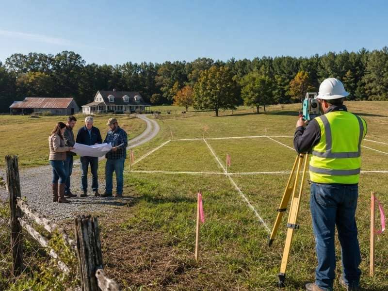
How Land Surveyors Help Buyers Understand Property Lines
Most buyers picture their property lines in the wrong place. They look at a fence, a hedge or a tree row and assume that’s the edge. Often it isn’t. Someone put those markers there for looks or convenience, not a survey.
A land surveyor finds the real lines. They pull the legal description, measure from known points and set markers at the true corners. The result can surprise people. A yard might be smaller than it looked, or a strip the seller showed off might belong to someone else.
Knowing the real boundary changes how you see a property. It tells you exactly what you can build on, fence off or call your own. Without it, you’re trusting a guess that could cost you later. The line on the ground is the only one that counts.
Why Land Surveyors Warn Buyers About Trusting Online Maps
Online maps are handy, but no one built them for buying land. They give you a rough shape and a general spot. The crisp lines you see on the screen are estimates, not exact boundaries. People treat them as gospel anyway.
The gap can be wide. A property line on a map app can sit several feet off from where it really is. That’s fine for finding a driveway. It’s a problem when you’re deciding where a house or fence can go. A few feet can mean a setback violation or a fight with a neighbor.
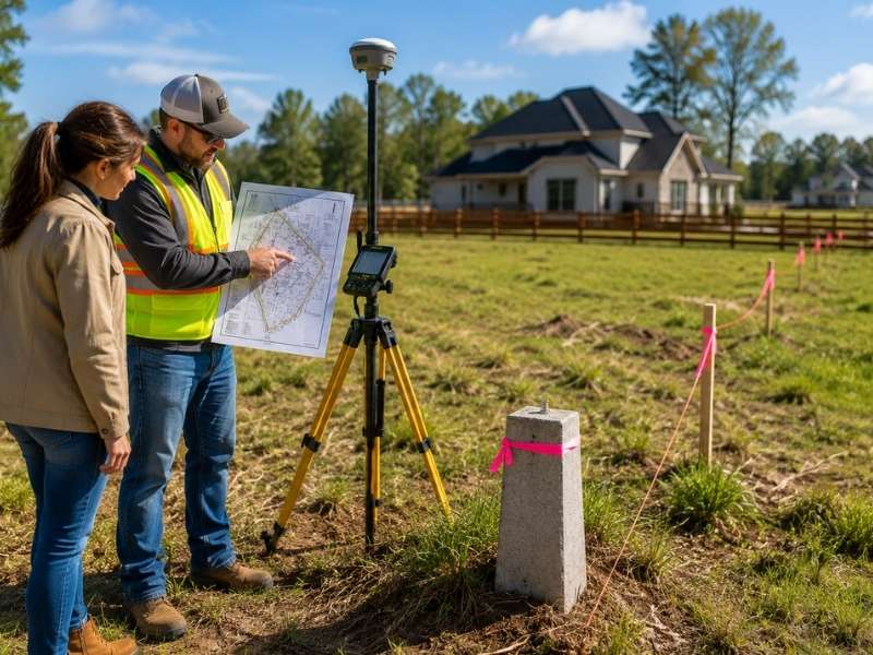
Surveyors don’t rely on those pictures. They work from recorded deeds, plats and field measurements taken on the actual ground. That’s how they pin a boundary down to inches instead of a fuzzy guess. When real money is on the line, that precision is what a buyer needs.
How Land Surveyors Help Buyers Learn About Features on the Land
A property holds clues, and a surveyor knows how to read them. Fences, driveways, sheds and old utility lines all show up on a survey. Each one tells a buyer something useful about the land they’re about to own.
Some features hint at trouble. A driveway that crosses onto the next lot, or a neighbor’s shed sitting over the line, can turn into a dispute after closing. A surveyor spots these overlaps early, while you can still bring them up. Other features matter for planning. Knowing where an old septic field or buried line runs can shape where you build.
This is the kind of detail a quick visit never reveals. A buyer might stroll the land and notice nothing wrong. The survey lays it all out in one clear picture, so you buy with your eyes open instead of fingers crossed.
Why Land Surveyors Encourage Buyers to Ask Questions Before Closing
Surveyors see the same regret over and over. A buyer closes, moves in, then learns about a problem that a single question would have caught. Once the deal closes, fixing it gets a lot harder.
Before closing is the time to speak up. Ask whether the property has a current survey. Ask if anyone has checked the corners lately. Ask what easements or shared access run through the lot. The answers can change your offer, or even your decision to buy.
There’s no penalty for asking too much. Sellers expect questions on a land deal, and a good surveyor welcomes them. The buyers who get burned are usually the ones who stayed quiet to seem easygoing. A few questions now beat years of headaches later.
Frequently Asked Questions
What is the most common mistake that land surveyors see new land buyers make?
The biggest one is rushing in without checking the property first. Many buyers trust how the land looks and skip a closer look at its boundaries and records. Slowing down to learn the facts prevents most of the trouble that follows.
Why do land surveyors say it is important to know the property lines?
Property lines mark exactly what you own and what you don’t. Fences and hedges often sit in the wrong spot, so you can’t trust them. A survey shows the true edges, which tells you what you can build on and use.
Why do land surveyors warn buyers not to rely only on online maps?
Map apps show an estimate of a boundary, not its exact location. That guess can be off by several feet, enough to cause real problems. Surveyors use deeds, plats and field measurements to find the line precisely.
How do land surveyors help buyers understand the land they want to purchase?
They mark the true boundaries and note features like fences, driveways and utility lines. They also flag anything that crosses onto a neighbor’s land. With that picture, a buyer can decide with full information.
Why do land surveyors recommend asking questions before buying land?
Questions raised before closing are far easier to act on than problems found after. Asking about the survey, the corners and any easements can reshape an offer. It helps a buyer move forward with confidence instead of doubt.

 Land Surveyors are professionals who measure and make precise measurements to determine the size and boundaries of a piece of real estate. While this is a simplistic definition, boundary surveying is one of the most common types of surveying related to home and land owners. If you fall into the following categories, please click on the appropriate link for more information on that subject: