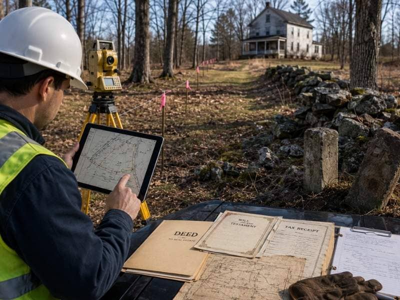
A construction staking survey rarely happens just once on a new home build. Builders call the surveyor back again and again, and that surprises a lot of first time clients. The reason is simple. A new home moves through several stages. Each stage needs its own set of stakes in the ground.
Every Build Stage Needs Its Own Stakes
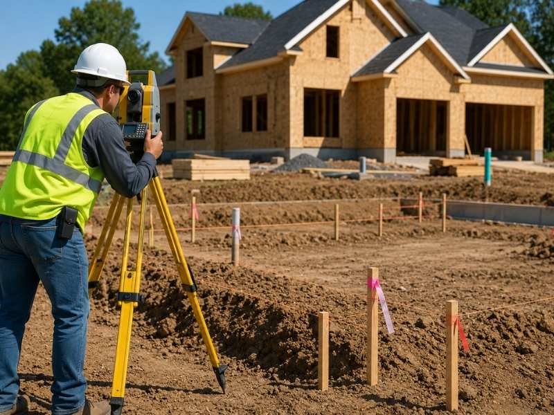
A house does not go up all at once. Crews dig the foundation first, pour concrete, frame the walls, then finish the grading around the lot. Each of these steps needs accurate marks to guide the work.
Foundation stakes show the crew exactly where to dig and pour. Once that concrete sets, those first stakes are gone or covered. The surveyor has to come back and set new marks for the framing stage. Then the surveyor returns again for final grading. This is normal. It does not mean anyone made a mistake.
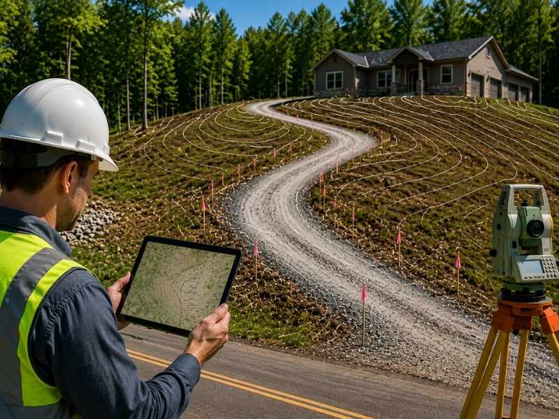
Sitework and Utilities Get Staked After the Foundation
Once the foundation sits in place, a second round of staking begins. Driveways, sidewalks and drainage all need their own layout marks. Utility lines for water, sewer and power get staked too.
These features depend on where the house actually sits, not just where the plans say it should sit. A surveyor cannot mark a driveway location until the foundation work confirms the exact spot. This is why most builds need a second or even a third staking visit before construction wraps up.
Plan Changes Mean New Stakes
Home plans change more often than most buyers expect. A builder might shift a garage, widen a porch or adjust a setback line after work has already started. Each of these changes can make the old stakes wrong.
Once a plan changes, the marks in the ground no longer match the new design. The surveyor has to come out, remove the old stakes, and set new ones that match the updated plan. Builders who handle custom homes deal with this often. Buyers tend to request changes once they see the site in person.
Inspections Often Call for a Fresh Survey Visit
Local building departments often require proof that a structure sits in the right spot. This usually happens at key points, such as after the foundation forms go up but before concrete gets poured.
An inspector may ask for proof that the foundation matches the approved site plan. This check protects the builder from costly teardown work later. It also gives the city a clear record that the project follows the rules. Skipping this step can stall a project for weeks while the city sorts out paperwork.
A Final Survey Confirms the Finished Home Matches the Plan
The last staking related visit happens after construction ends. This is called an as built survey. It serves a different purpose than the staking done earlier. Instead of guiding new work, it checks the finished result.
The surveyor measures the completed structure and compares it to the approved plans. This confirms the home sits within the correct setback lines. It also confirms the home does not cross any easement. Lenders and title companies often require this final survey before closing. That makes it one of the most important visits in the whole process.
Builders who understand why these visits repeat tend to plan for them from the start. A construction staking survey is not a one time service. It follows the project through every major stage. This protects the builder from costly errors at each step. It also keeps the schedule on track, since fixing a mistake after the fact almost always takes longer than the original staking visit would have.
Frequently Asked Questions
Why does a new home need staking more than once?
A new home moves through several build stages, and each one needs fresh ground marks. Foundation work, sitework and final grading all depend on staking done at the right point in the process.
Does needing a second staking visit mean something went wrong?
Not usually. Most repeat visits happen because the project reached a new stage, not because of an error. Foundation stakes often get covered or removed once concrete is poured, so the next stage needs new marks.
Who decides when a new staking visit is needed?
The builder, the surveyor, or the local building department can all call for a new visit. Plan changes, inspection rules, and new construction stages are the most common reasons behind it.
What happens during a final as built survey?
A surveyor measures the finished structure and compares it to the approved plans. This step confirms the home sits in the right spot and meets setback and easement rules.
Can a builder skip extra staking visits to save time?
Skipping a needed visit raises the risk of placement errors that cost far more to fix later. Most builders plan for several staking visits from the very start of the project for this reason.