↓
 

Dothan Land Surveying

Your local licensed surveying firm.

Dothan Land Surveying
  • Home
  • Services
  • ALTA Title Survey
  • Boundary Surveying
  • Construction Survey
  • Drone LiDAR Mapping
  • Flood Survey | Elevation Certificate
  • Land Surveying
  • Lot Survey
  • Topographic Survey
  • About Us
  • Blog
  • Contact Us
Home 1 2 3 … 14 15 >>

Post navigation

← Older posts

Welcome to Dothan Land Surveying

Dothan Land Surveying Posted on August 9, 2010 by Dothan SurveyorDecember 31, 2017

Welcome to Dothan Land Surveying website

This site is intended to provide you with information on Land Surveying in the Dothan, AL and Houston County area of Alabama. If you’re looking for a Dothan Land Surveyor, you’ve come to the right site. If you’d rather talk to someone about your land surveying needs, please call our toll free number at (888) 936-8426 today. For more information, please continue to read.

dothan land surveyingLand Surveyors are professionals who measure and make precise measurements to determine the size and boundaries of a piece of real estate.  While this is a simplistic definition, boundary surveying is one of the most common types of surveying related to home and land owners. If you fall into the following categories, please click on the appropriate link for more information on that subject:

Dothan Land Surveying services:

    1. I need to know where my property corners or property lines are. (Boundary Survey)
    2. I have a loan closing or re-finance coming up on my home in a subdivision. (Lot Survey)
    3. I need a map of my property with contour lines to show elevation differences for my architect or engineer. (Topo Survey)
    4. I’ve just been told I’m in a flood zone or I ‘ve been told I need an elevation certificate in order to obtain flood insurance or prove I don’t need it. (Flood Survey)
    5. I’m purchasing a lot/house in a recorded subdivision. (Lot Survey – See Boundary Survey)
    6. I’m purchasing a larger tract of land, acreage, that hasn’t been subdivided in the past. (Boundary Survey)


Contact Dothan Land Surveying services Now.

Posted in blog, flood damage, house construction, land surveying, land surveyor | Tagged Dothan AL Land Surveyor, Dothan Land Surveying, dothan land surveyor, land surveying dothan, land surveyor, land surveyor dothan, land surveyor dothan AL

Before You Divide Family Land, a Boundary Survey Can Prevent Years of Conflict

Dothan Land Surveying Posted on July 6, 2026 by Dothan SurveyorJuly 3, 2026
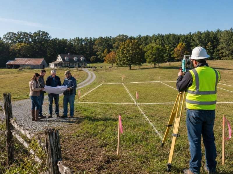
 Before you divide family land, a boundary survey can prevent years of conflict by clearly marking legal property lines and proposed land divisions for family members.

Splitting up family land sounds simple until everyone tries to agree on where one person’s share ends and another’s begins. A boundary survey settles that question before it turns into a longer, messier one. It’s one of the most overlooked steps in the process, and often the one that saves the most trouble later.

Why You Need a Boundary Survey First

A boundary survey shows the true property lines, not the lines everyone assumes are there. Families often have a general sense of how big the land is, but a general sense isn’t the same as an accurate map. Without a survey, it’s easy for two people to picture the split differently, and that gap in understanding can grow into a real disagreement.

Getting a survey done first gives everyone the same starting point. It removes the guesswork and replaces it with facts everyone can look at together. That single step often prevents a lot of back and forth before the land is even divided.

Making Each Land Share Clear

Once the true boundaries are mapped, a survey can show exactly where each new share of land may start and end. This turns a vague idea, like “the north half” or “the section near the creek,” into something specific and measurable.

That clarity matters more than it might seem at first. When each person can see their share marked out on paper, there’s less room for confusion about what they’re getting. It also makes it easier to divide the land fairly, since everyone is working from the same accurate picture instead of memory or assumption.

Not Relying on Old Fences or Trees

It’s tempting to use an old fence line, a row of trees, or a worn path as the property line, especially if it’s been treated that way for years. The problem is that these markers were often placed for convenience, not accuracy. A fence might have gone up decades ago simply because it was the easiest spot to build it, not because it followed the actual legal line.

A boundary survey gives a clearer answer than any fence or tree ever could. It relies on recorded measurements and legal documents rather than something that was eyeballed generations ago. Relying on old markers can lead to disputes if the real line turns out to be several feet, or even more, in a different spot than everyone assumed.

Checking Access to Each New Piece

Dividing land isn’t just about drawing lines. Each new piece needs a way in and out, whether that’s a road, a driveway, or a legal easement across someone else’s section. This is easy to overlook when a family is focused on how much land each person gets, rather than how they’ll actually reach it.

A survey can identify these access points early, before the division is finalized. That way, no one ends up with a piece of land that looks good on paper but is difficult or even legally complicated to reach. Sorting this out ahead of time saves a lot of frustration once the land has already been split.

Helping Families Avoid Future Arguments

Land disputes between family members can drag on for years and strain relationships long after the original issue is settled. Clear, documented boundaries take a lot of the guesswork out of the process, which makes it easier for everyone to make fair, informed decisions from the start.

When each person knows exactly what they’re getting and can see it backed up by a proper survey, there’s simply less to argue about. The goal isn’t just avoiding conflict today. It’s making sure the division holds up years down the road, even after memories fade or family members pass the land on to the next generation.

Frequently Asked Questions

What exactly does a boundary survey tell you? 

It pinpoints the legal edges of a property, showing exactly where the land begins and where it stops.

Is a boundary survey really necessary before splitting up family land? 

It gives everyone a shared, accurate view of the property before any lines are drawn, which cuts down on mixed-ups and disagreements once the split happens.

Is an old fence line a safe bet for marking the property line? 

Not necessarily. Fences are often built where it was easiest, not where the legal line actually runs. A survey confirms the real boundary instead of guessing from what’s already there.

Will every new section of land have a way to get in and out? 

It should. Each piece needs a legal, workable way to reach it, such as a road, driveway, or easement, and that’s something a survey can confirm ahead of time.

Does getting a survey done actually reduce family conflict over land? 

It can. When everyone works from the same accurate information, there’s less room for disagreement and more room for a fair, well-informed split.

Posted in boundary surveying | Tagged boundary survey

Land Surveyors Share the Most Common Mistake New Land Buyers Make

Dothan Land Surveying Posted on July 3, 2026 by Dothan SurveyorJune 24, 2026
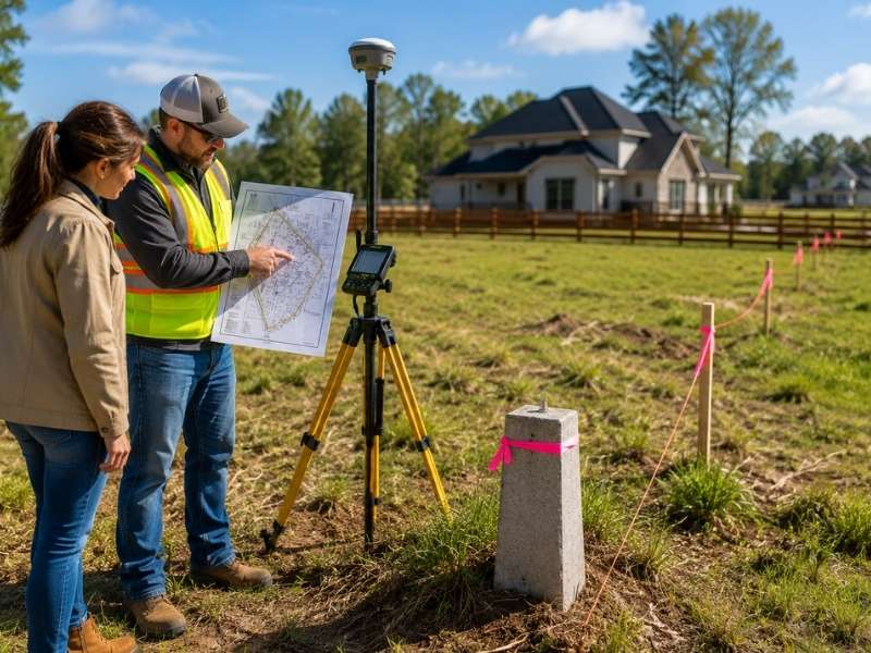
Land surveyors help a new land buyer understand property lines, boundary markers, and lot conditions before purchasing land.

Land surveyors watch it happen all the time. A buyer falls for a piece of land, signs fast and sorts out the details later. The land looks perfect, so they don’t slow down. That rush is the mistake surveyors see most.

Buying land isn’t like buying a car. You can’t test drive a property line or take the boundaries for a spin. What you see on a walk-through is only part of the story. The rest sits in records, measurements and old markers that an untrained eye will miss.

A little research up front saves a lot of regret. Before you commit, you need to know what you’re actually buying. That means the real size of the lot and where its edges sit. A surveyor answers those questions with facts, not guesses. Buyers who take that step rarely get blindsided after closing.

Why Land Surveyors Say Buyers Should Not Skip Research

Most buyers do less homework on land than they do on a phone. They read reviews for a gadget, then buy an acre on a gut feeling. Land surveyors see the gap, and they wish more people would close it.

The trouble is that land hides its problems well. A lot can look clean and open while carrying issues you can’t see from the curb. An old boundary dispute, a shared driveway or a missing corner marker won’t show up on a sunny afternoon visit. They show up later, usually at the worst time.

Good research turns up these facts before money changes hands. A buyer who asks for a survey, reads the deed and checks the records walks in with real knowledge. That buyer can spot a bad deal or negotiate a fair one. The buyer who skips all that is rolling the dice.

How Land Surveyors Help Buyers Understand Property Lines

Most buyers picture their property lines in the wrong place. They look at a fence, a hedge or a tree row and assume that’s the edge. Often it isn’t. Someone put those markers there for looks or convenience, not a survey.

A land surveyor finds the real lines. They pull the legal description, measure from known points and set markers at the true corners. The result can surprise people. A yard might be smaller than it looked, or a strip the seller showed off might belong to someone else.

Knowing the real boundary changes how you see a property. It tells you exactly what you can build on, fence off or call your own. Without it, you’re trusting a guess that could cost you later. The line on the ground is the only one that counts.

Why Land Surveyors Warn Buyers About Trusting Online Maps

Online maps are handy, but no one built them for buying land. They give you a rough shape and a general spot. The crisp lines you see on the screen are estimates, not exact boundaries. People treat them as gospel anyway.

The gap can be wide. A property line on a map app can sit several feet off from where it really is. That’s fine for finding a driveway. It’s a problem when you’re deciding where a house or fence can go. A few feet can mean a setback violation or a fight with a neighbor.

Surveyors don’t rely on those pictures. They work from recorded deeds, plats and field measurements taken on the actual ground. That’s how they pin a boundary down to inches instead of a fuzzy guess. When real money is on the line, that precision is what a buyer needs.

How Land Surveyors Help Buyers Learn About Features on the Land

A property holds clues, and a surveyor knows how to read them. Fences, driveways, sheds and old utility lines all show up on a survey. Each one tells a buyer something useful about the land they’re about to own.

Some features hint at trouble. A driveway that crosses onto the next lot, or a neighbor’s shed sitting over the line, can turn into a dispute after closing. A surveyor spots these overlaps early, while you can still bring them up. Other features matter for planning. Knowing where an old septic field or buried line runs can shape where you build.

This is the kind of detail a quick visit never reveals. A buyer might stroll the land and notice nothing wrong. The survey lays it all out in one clear picture, so you buy with your eyes open instead of fingers crossed.

Why Land Surveyors Encourage Buyers to Ask Questions Before Closing

Surveyors see the same regret over and over. A buyer closes, moves in, then learns about a problem that a single question would have caught. Once the deal closes, fixing it gets a lot harder.

Before closing is the time to speak up. Ask whether the property has a current survey. Ask if anyone has checked the corners lately. Ask what easements or shared access run through the lot. The answers can change your offer, or even your decision to buy.

There’s no penalty for asking too much. Sellers expect questions on a land deal, and a good surveyor welcomes them. The buyers who get burned are usually the ones who stayed quiet to seem easygoing. A few questions now beat years of headaches later.

Frequently Asked Questions

What is the most common mistake that land surveyors see new land buyers make?

The biggest one is rushing in without checking the property first. Many buyers trust how the land looks and skip a closer look at its boundaries and records. Slowing down to learn the facts prevents most of the trouble that follows.

Why do land surveyors say it is important to know the property lines?

Property lines mark exactly what you own and what you don’t. Fences and hedges often sit in the wrong spot, so you can’t trust them. A survey shows the true edges, which tells you what you can build on and use.

Why do land surveyors warn buyers not to rely only on online maps?

Map apps show an estimate of a boundary, not its exact location. That guess can be off by several feet, enough to cause real problems. Surveyors use deeds, plats and field measurements to find the line precisely.

How do land surveyors help buyers understand the land they want to purchase?

They mark the true boundaries and note features like fences, driveways and utility lines. They also flag anything that crosses onto a neighbor’s land. With that picture, a buyer can decide with full information.

Why do land surveyors recommend asking questions before buying land?

Questions raised before closing are far easier to act on than problems found after. Asking about the survey, the corners and any easements can reshape an offer. It helps a buyer move forward with confidence instead of doubt.

Posted in land surveyor | Tagged land surveyor

LiDAR Mapping and the Drainage Issues You Cannot See From Ground Level

Dothan Land Surveying Posted on July 1, 2026 by Dothan SurveyorJuly 3, 2026
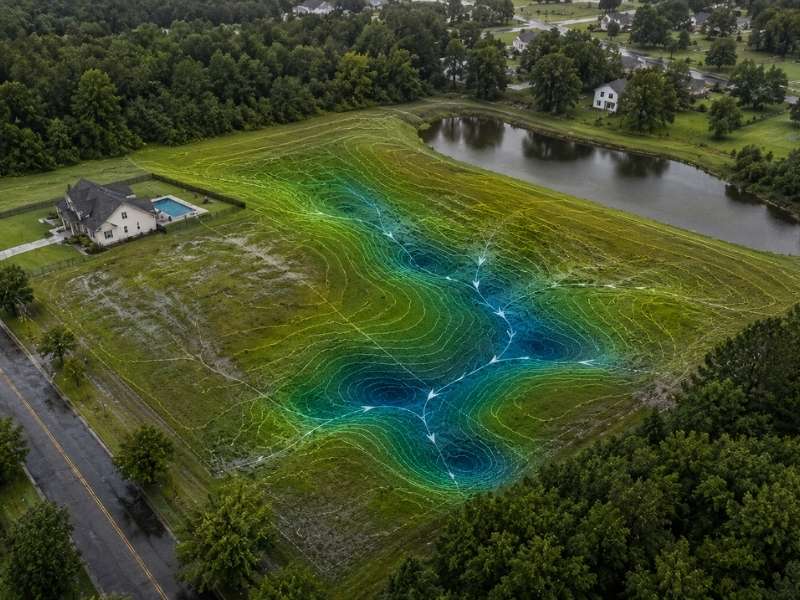
LiDAR mapping reveals hidden drainage issues, elevation changes, and water flow paths across a residential property that appear invisible from ground level.

LiDAR mapping captures elevation data in fine detail. No person walking a site can match that detail. It shows the small rises and dips that decide where water goes when heavy rain falls. In areas that deal with rain again and again, that detail matters a lot. A property can look fine on a dry day. It can still hide a drainage problem waiting to surface.

Why Ground-Level Walkthroughs Miss the Drainage Problems That Matter Most

Walking a property gives you a feel for the land. It rarely shows the small slope changes that control water flow. A dip of just a few inches can send water toward a foundation instead of away from it. From eye level, that kind of change often blends into the rest of the yard.

LiDAR mapping removes the guesswork. It records elevation across an entire site in fine detail. It does not just check a few spots someone happens to notice. This gives buyers and builders a real picture of how the ground behaves. It does not rely on what looks flat or dry on a calm day.

Spotting Hidden Depressions and Flow Paths With LiDAR Elevation Data

A shallow depression rarely looks like much in person. It might pass for a slight low spot in the grass. Once LiDAR elevation data gets mapped out, that same depression often shows up as part of a bigger pattern. That pattern can include many dips and channels across the property.

These flow paths matter. They show where rainwater wants to travel. A path that looks small on a clear day can carry a lot of water once a storm hits. Seeing this pattern early lets a builder plan grading that works with the land. That beats fighting the land later.

Mapping Where Water Converges During Recurring Heavy Rain

Some areas get heavy rain often enough that drainage problems repeat in the same spots. They happen year after year. LiDAR elevation data helps explain why. It shows where water from different parts of a property tends to gather into one low area. Water from nearby land can join in too.

A site might have several small flow paths. On their own, they look harmless. Once heavy rain hits, those paths can combine into one larger flow. That flow can overwhelm a single low point fast. Mapping this pattern early helps explain flooding that seems to come out of nowhere.

Why Saturated Soil Changes How a Site Handles the Next Storm

Soil that stays wet from frequent rain acts differently than dry ground. Wet soil soaks up less water. More rain runs off the surface instead of sinking in. A site with a history of frequent rain often reaches this soaked state fast.

Elevation data alone does not show soil moisture. It does show where runoff will likely land once the ground stops soaking up water well. Pairing that elevation picture with a site’s rain history gives a clearer sense of risk. It helps show where the next storm is likely to cause trouble.

Using LiDAR Data to Plan Drainage Fixes Before They Become Repeat Problems

Many drainage fixes happen after a problem already shows up. Often, this happens more than once. LiDAR data flips that order around. It gives engineers and builders the elevation detail needed to plan grading or drainage features before construction starts. They do not have to react to standing water after the fact.

This matters most for sites with a known pattern of heavy rain. A fix based on one bad storm might miss the bigger flow pattern across the property. Planning from full elevation data gives a better shot at solving the real issue. That beats patching the same low spot again next season.

Frequently Asked Questions

Can LiDAR mapping detect drainage problems that aren’t visible during a site walkthrough?

LiDAR mapping records elevation in much finer detail than a person can judge by eye. This makes it possible to spot shallow depressions and flow paths that look unremarkable on a normal walkthrough. These small features often explain drainage issues that otherwise seem to have no clear cause.

How does LiDAR data help identify where water collects after recurring heavy rain?

LiDAR elevation data shows how separate low points and flow paths across a property connect to each other. This makes it easier to see where water from many directions comes together in one spot. Finding that meeting point helps explain why certain spots flood again and again.

Does LiDAR mapping work on properties with dense vegetation or tree cover?

LiDAR can capture ground elevation even where plants cover parts of a site. This allows mapping to continue on properties where a full ground-level check would be hard. The resulting elevation picture still reflects the real terrain beneath the cover.

How is LiDAR-based drainage mapping different from a standard topographic survey?

A standard topographic survey can show elevation, but LiDAR collects far more data points across a site in less time. This density makes it easier to catch small drainage features that fewer measured points might miss. The result is a more detailed picture of how water moves across the land.

Can LiDAR data help prevent the same drainage problem from happening again after each storm?

LiDAR data gives engineers and builders a full elevation picture before any fix gets designed. This helps target the real flow pattern behind a recurring problem instead of guessing from one storm. A fix built from that fuller picture is more likely to hold up through future heavy rain.

Posted in Drone LiDAR Mapping | Tagged Drone LiDAR Mapping

Post navigation

← Older posts

SEO & Online Marketing By:

SEO Company Auburn

Contact Us

    Recent Posts

    • Before You Divide Family Land, a Boundary Survey Can Prevent Years of Conflict
    • Land Surveyors Share the Most Common Mistake New Land Buyers Make
    • LiDAR Mapping and the Drainage Issues You Cannot See From Ground Level
    • Why Builders Request Construction Staking Surveys More Than Once
    • Land Survey Cost for Inherited Property With Missing Corners

    © 2015 Dothan Land Surveying

    Dothan, Alabama
    Privacy Policy | Glossary | Terms of Use
    ©2026 - Dothan Land Surveying - Weaver Xtreme Theme
    ↑