
Before You Divide Family Land, a Boundary Survey Can Prevent Years of Conflict
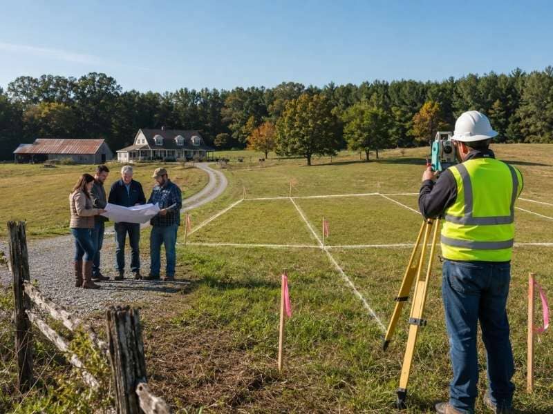
Splitting up family land sounds simple until everyone tries to agree on where one person’s share ends and another’s begins. A boundary survey settles that question before it turns into a longer, messier one. It’s one of the most overlooked steps in the process, and often the one that saves the most trouble later.
Why You Need a Boundary Survey First
A boundary survey shows the true property lines, not the lines everyone assumes are there. Families often have a general sense of how big the land is, but a general sense isn’t the same as an accurate map. Without a survey, it’s easy for two people to picture the split differently, and that gap in understanding can grow into a real disagreement.
Getting a survey done first gives everyone the same starting point. It removes the guesswork and replaces it with facts everyone can look at together. That single step often prevents a lot of back and forth before the land is even divided.
Making Each Land Share Clear
Once the true boundaries are mapped, a survey can show exactly where each new share of land may start and end. This turns a vague idea, like “the north half” or “the section near the creek,” into something specific and measurable.
That clarity matters more than it might seem at first. When each person can see their share marked out on paper, there’s less room for confusion about what they’re getting. It also makes it easier to divide the land fairly, since everyone is working from the same accurate picture instead of memory or assumption.
Not Relying on Old Fences or Trees
It’s tempting to use an old fence line, a row of trees, or a worn path as the property line, especially if it’s been treated that way for years. The problem is that these markers were often placed for convenience, not accuracy. A fence might have gone up decades ago simply because it was the easiest spot to build it, not because it followed the actual legal line.
A boundary survey gives a clearer answer than any fence or tree ever could. It relies on recorded measurements and legal documents rather than something that was eyeballed generations ago. Relying on old markers can lead to disputes if the real line turns out to be several feet, or even more, in a different spot than everyone assumed.
Checking Access to Each New Piece
Dividing land isn’t just about drawing lines. Each new piece needs a way in and out, whether that’s a road, a driveway, or a legal easement across someone else’s section. This is easy to overlook when a family is focused on how much land each person gets, rather than how they’ll actually reach it.
A survey can identify these access points early, before the division is finalized. That way, no one ends up with a piece of land that looks good on paper but is difficult or even legally complicated to reach. Sorting this out ahead of time saves a lot of frustration once the land has already been split.
Helping Families Avoid Future Arguments
Land disputes between family members can drag on for years and strain relationships long after the original issue is settled. Clear, documented boundaries take a lot of the guesswork out of the process, which makes it easier for everyone to make fair, informed decisions from the start.
When each person knows exactly what they’re getting and can see it backed up by a proper survey, there’s simply less to argue about. The goal isn’t just avoiding conflict today. It’s making sure the division holds up years down the road, even after memories fade or family members pass the land on to the next generation.
Frequently Asked Questions
What exactly does a boundary survey tell you?
It pinpoints the legal edges of a property, showing exactly where the land begins and where it stops.
Is a boundary survey really necessary before splitting up family land?
It gives everyone a shared, accurate view of the property before any lines are drawn, which cuts down on mixed-ups and disagreements once the split happens.
Is an old fence line a safe bet for marking the property line?
Not necessarily. Fences are often built where it was easiest, not where the legal line actually runs. A survey confirms the real boundary instead of guessing from what’s already there.
Will every new section of land have a way to get in and out?
It should. Each piece needs a legal, workable way to reach it, such as a road, driveway, or easement, and that’s something a survey can confirm ahead of time.
Does getting a survey done actually reduce family conflict over land?
It can. When everyone works from the same accurate information, there’s less room for disagreement and more room for a fair, well-informed split.