
Drone Surveying or Traditional Field Work? Which Makes More Sense for Large Acreage
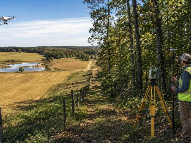
Drone surveying is often the first option farmers and hunting land owners consider when managing large acreage. The question is whether it’s better to send a drone up for a quick overview or send a crew out to walk the ground. The answer depends on what the land looks like and what the project actually needs.
Matching the Method to the Land
Open farmland tends to favor drone surveying. Fields, pastures, and cleared hunting tracts give a drone a clear view from above, so it can cover a lot of ground fast. A single flight can capture the shape of the property, the layout of fields, and features like ponds or fence lines without anyone stepping foot on the land.
Thick hunting woods tell a different story. Heavy tree cover blocks the camera’s view of the ground, so a drone flying over dense timber mostly sees the tops of trees. On land like that, traditional field work still does the heavy lifting, since a surveyor on the ground can push through brush and locate details a camera never could.
Speed Versus Precision
Drone surveying usually wins on speed, especially across large, open acreage. What might take a crew days to walk can often be captured in a single flight or two. For farmers who need a fast overview before planting season or a landowner mapping out a hunting lease, that speed can matter a lot.
Field work trades some of that speed for precision. A surveyor working on the ground can locate exact points, measure with tools built for legal accuracy, and confirm details a drone simply can’t verify from the air. On a large farm or hunting property, the right choice often comes down to whether the goal is a general layout or something that needs to hold up as an official record.
What Farmers and Hunting Land Owners Actually Need to Know
For agricultural land, drone surveying can map field boundaries, irrigation paths, and drainage patterns, giving a farmer a useful planning tool without slowing down the season. For hunting tracts, it can outline clearings, roads, and food plots, which helps with planning stands, trails, and access points.
But neither of those things settles a legal boundary. Property corners and true lines still need to be set by a surveyor working on the ground, using recorded measurements rather than what’s visible from above. This matters most when a farm is being divided among family, when a hunting lease covers multiple owners, or when a fence or tree line has been treated as a boundary for years without ever being confirmed.
Making the Call for Your Land
There isn’t a single right answer for every property. A cleared, open farm with well defined edges might only need drone surveying for planning purposes. A large hunting tract with mixed terrain, some open and some heavily wooded, often benefits from both methods working together.
Using a drone for the open sections and field work for the dense timber or legal boundary points gives a fuller, more accurate picture than either method alone. It also tends to save money compared to sending a full crew across every acre when a drone can handle the easy ground just as well.
The best approach starts with a clear goal. Planning a new field layout calls for something different than confirming a legal boundary before a sale. Once that goal is set, it’s much easier to decide whether drone surveying, field work, or a combination of both is the right fit.
Frequently Asked Questions
Does drone surveying work well on farmland and hunting tracts?
Yes, especially on open fields, pastures, and cleared areas where the camera has a clear view of the ground.
When does a property still need someone on the ground?
Thick woods, dense brush, and any work involving legal property corners still call for traditional field work.
Which method is faster for large acreage?
Drone surveying is usually quicker across open land. Field work takes more time but delivers closer, more precise ground detail.
Can a drone confirm a legal property line?
No. Drone imagery is useful for planning and general layout, but a licensed surveyor still has to confirm legal boundaries on the ground.
Is it common to use both methods on the same property?
Yes. Many large farms and hunting tracts use a drone for the open ground and field work for wooded areas or boundary confirmation.