
Why Hilly Subdivision Developers Order a Topographic Survey First
Hilly subdivisions look clean on a site plan. Then the bids come in. Retaining walls cost more than most developers expect. Grading surprises can blow a budget wide open. A topographic survey done early catches those surprises before they turn into change orders.
What Is a Topographic Survey?
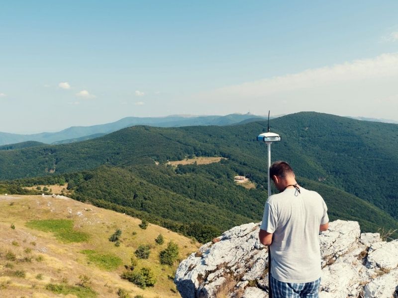
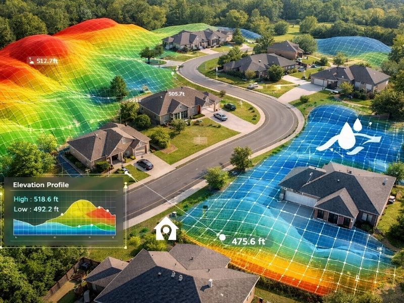
A topographic survey maps a land’s surface. It records elevation changes, slopes and existing features like trees, drainage paths and structures. Surveyors collect thousands of data points across the site. The result is a contour map that shows exactly how the ground rises and falls.
This isn’t the same as a boundary survey. A boundary survey tells you where your property lines are. A topographic survey tells you what’s happening inside those lines, elevation-wise.
Why Hilly Sites Need More Than a Boundary Survey
Flat lots are forgiving. Hilly lots aren’t.
A 10-foot elevation change across a 60-foot lot changes everything: wall heights, drainage design, cut-and-fill ratios and foundation types. Without elevation data, engineers are guessing. Guessing costs money.
Retaining wall design depends on knowing exactly how steep each slope is. A wall holding back 4 feet of soil is a very different structure than one holding back 12 feet. The topographic survey gives engineers the numbers they need to design walls that won’t fail.
How Topographic Data Drives Grading Plans
Cut and Fill Calculations
Grading is moving dirt. Cut means removing soil. Fill means adding it. The goal is to balance the two so you’re not hauling material off-site or trucking it in. Both are expensive.
A topographic survey lets the civil engineer calculate cut-and-fill volumes before anyone touches the ground. On a hilly site, this math matters a lot. Getting it wrong means surprise costs in the six figures.
Drainage Design
Water follows elevation. On a hilly site, water can collect in low spots, erode slopes or flood finished lots if drainage isn’t designed right. Before design starts, check your parcel against the FEMA Flood Map Service Center to confirm flood zone status and any drainage overlay requirements.
The topographic map shows where water will naturally flow. Engineers use that data to place storm drains, swales and retention areas in the right spots. Without it, drainage is a guessing game. Bad drainage on a hilly site is an expensive fix.
Spotting Problem Areas Early
Some spots on a hilly site are just harder to build on. Steep slopes may need deep cuts. Soft soils in low areas may need special foundations. Rock close to the surface can make grading extremely slow and costly.
A topographic survey won’t reveal soil conditions on its own. But it flags areas worth investigating further. Pair it with a geotechnical report and you have a clear picture of what you’re working with.
Retaining Walls: The Hidden Cost in Hilly Subdivisions
Retaining walls are often the biggest surprise in a hilly subdivision budget.
Early project estimates sometimes use a rough cost-per-lot figure. That figure doesn’t account for a site where half the lots need 8-foot walls and the other half need none. The topographic survey separates those lots before budgets are locked in.
Wall Heights and What They Mean for Your Budget
- Walls under 4 feet: Usually simple. Gravity or timber walls work fine.
- Walls from 4 to 8 feet: These need engineering. Concrete blocks or poured concrete are common solutions.
- Walls over 8 feet: Full engineered design required. These are expensive. They also need permits and inspections in most jurisdictions.
The topographic survey tells you which lots need which walls. That information feeds directly into the grading plan and the project budget.
Tiered Wall Systems
On steep lots, one tall wall isn’t always the right answer. Tiered walls, smaller walls stacked with a flat bench between them, are often cheaper and easier to permit. Designing a tiered system requires exact elevation data. The topographic survey provides it.
When to Order the Survey
Before design. Before engineering. Before you submit anything to the city or county.
Get the topographic survey done as part of due diligence. Use it to confirm the site can support the subdivision you’re planning. If grading costs are too high, you want to know before you close on the land, not after.
Some developers skip this step to save a few thousand dollars upfront. Then they spend tens of thousands dealing with grading surprises during construction. The math doesn’t work.
What the Survey Report Includes
A standard topographic survey for a subdivision site typically includes:
- Contour lines at 1-foot or 2-foot intervals
- Spot elevations at key points across the site
- Locations of drainage features and flow paths
- Existing structures and utilities (if present)
- Tree locations and sizes
- Benchmarks tied to a known elevation reference
The civil engineer uses this to build the grading and drainage plan. The structural engineer uses it to design retaining walls. Your cost estimator uses it to build a realistic budget.
Frequently Asked Questions
How accurate is a topographic survey?
Modern surveys use GPS and total station equipment. Vertical accuracy is typically within 0.1 feet. For grading and retaining wall design, that’s plenty of precision.
How long does a topographic survey take?
For a typical subdivision site of 5 to 20 acres, field work takes one to three days. Processing and delivering the final map usually adds one to two weeks.
Does a topographic survey replace a geotechnical report?
No. A topographic survey maps the surface. A geotechnical report analyzes what’s below it: soil type, bearing capacity and rock depth. You’ll likely need both for a hilly subdivision.
Can drone or aerial data replace a traditional survey?
Drone-based surveys are faster and work well for large sites. For final engineering and permitting, many jurisdictions still require ground-control points tied to a licensed surveyor. Check with your local authority before assuming drone data alone is enough.
What does a topographic survey cost for a subdivision site?
Costs vary by site size, terrain and location. A 10-acre hilly site typically runs between $3,000 and $8,000. That’s a small cost compared to what it prevents in grading and wall budget surprises.