
A Flood Elevation Certificate May Be Only One Step in Planning a Home Addition
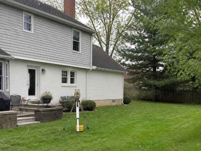
You want to add on to your home. Maybe a bigger kitchen, a new bedroom, or a sunroom out back. Someone tells you to get a flood elevation certificate first. That is good advice, but it is only part of the story. A certificate answers one question about your property. Building an addition raises several more. Knowing this early can save you delays, denied permits, and wasted money.
What a Flood Elevation Certificate Actually Documents
A flood elevation certificate is a form that records how high your home sits compared to flood levels. A licensed surveyor measures key points on your property and fills it out. The form uses standard FEMA fields, so lenders, insurers, and local offices can all read it the same way.
The certificate captures a few main things:
- The elevation of your lowest floor
- The elevation of the ground next to the building
- Your flood zone from the local flood map
- The base flood elevation for that zone
That last item matters most. The base flood elevation is the height floodwater is expected to reach in a bad flood. Your certificate compares your home to that number. If your floor sits above it, you are in better shape. If it sits below, you may face higher flood insurance and stricter building rules.
Here is the limit of the form. It describes elevation and flood risk. It does not tell you where you can build, how big you can build, or how water moves across your yard. For an addition, you need answers to all of those.
Why an Addition Can Require More Than Flood Elevation Data
An addition changes your home in ways a certificate does not track. You are adding floor area, weight, and a new footprint on the ground. Local rules look at more than flood height before they approve that.
In flood-prone parts of Dothan and Houston County, an addition below the base flood elevation can trigger extra requirements. Some areas limit how much you can improve a home in a flood zone before the whole structure must meet current standards. These rules can vary by property type, flood zone, and local office, so confirm them early.
Beyond flood rules, your addition has to fit the lot. That means checking real property lines, setback limits, drainage, and grade. A flood elevation certificate covers none of those directly. This is why builders and permit offices often ask for more survey work before a plan moves forward.
Getting this information up front helps you design once instead of twice. A plan that ignores boundaries or drainage often comes back with problems. Fixing it after permitting costs more than checking it early.
Property Boundaries and Setbacks Around the Proposed Addition
Before you decide where the addition goes, you need to know where your lot actually ends. Property boundaries are the legal edges of your land. They are not always where a fence, hedge, or old marker sits. A boundary survey confirms the true lines.
Setbacks are just as important. A setback is the minimum distance a structure must sit from a property line. Front, side, and rear setbacks can each be different. They limit how close your addition can come to the edge of your lot.
Setbacks decide your buildable area. Picture the space left after you subtract every setback from your lot. That leftover space is where an addition can legally go. If your dream sunroom crosses a setback line, the plan will not pass.
Corner lots and older neighborhoods can make this trickier. Some lots have unusual shapes or old easements that cut into the usable space. An easement is a strip where someone else, like a utility, has a right to access your land. You usually cannot build over it. A survey shows these limits before you commit to a design.
Check these boundary items early:
- The confirmed location of every property line
- Front, side, and rear setback distances
- Any recorded easements crossing the lot
- How much buildable area is left for the addition
Existing Grades and Drainage Around the Home
Grade means the slope and height of the ground. Drainage is how water flows across your property. Both matter a lot when you add on. A new addition changes the footprint, and that can change where water goes.
Add a roof and a slab, and rain that once soaked into the yard now runs off. If that water has nowhere good to go, it can pool against your home or flood a neighbor. In a flood-aware area, that is a real concern. Poor drainage can also work against the flood protection your elevation certificate describes.
A topographic survey maps the grades around your home. It shows high points, low points, and the direction water travels. Designers use this to place the addition, set the right floor height, and plan for runoff. Elevation information near drainage features can also help show how the proposed addition relates to existing ditches, low areas, and other areas where water may collect. Without it, you are guessing.
Grade also affects the addition’s foundation and floor level. You may need to raise the floor to stay above the base flood elevation. You may need to slope the ground away from the structure. These choices depend on real elevation data, not just the single certificate.
From Elevation Information to a Complete Site Plan
A flood elevation certificate is one input. A full addition plan pulls several inputs together into a site plan. A site plan is a drawing that shows your lot, your home, the new addition, and how they all fit the rules.
A complete plan usually blends:
- Flood elevation data from the certificate
- Boundary and setback lines from a survey
- Existing grades and drainage from a topographic survey
- Local permit and zoning requirements
- The builder’s design for the addition
When these pieces line up, permitting goes smoother. The office can see that your addition sits inside the setbacks, respects easements, handles water, and meets flood height rules. Missing pieces are a common reason plans stall.
Start survey work early if your timing depends on it. Permitting, closing, and construction schedules all move faster when the survey data is ready first. Requirements can vary by lot, flood zone, county, and project scope, so confirm what your project needs before you finalize a design. A surveyor can tell you which pieces apply to your addition.
Frequently Asked Questions
Do I need a new flood elevation certificate for an addition?
Often, yes. An addition changes your home’s footprint and sometimes its floor height. Your local office or lender may want current measurements that reflect the new plan. A surveyor can tell you if your existing certificate still works or if a new one is needed. Check this before you finalize the design.
Is a flood elevation certificate enough to get my additional permit?
Usually not on its own. The certificate covers flood elevation, but permits also look at boundaries, setbacks, drainage, and design. Many projects need a boundary survey and a topographic survey too. The exact list can vary by flood zone, county, and project. Ask your permit office early so nothing surprises you.
How long is a flood elevation certificate good for?
There is no fixed expiration on the form itself. It stays valid as long as it reflects your property and the current flood map. If the map changes or you alter the building, the old certificate may no longer match. For an addition, a surveyor can confirm whether yours is still accurate.